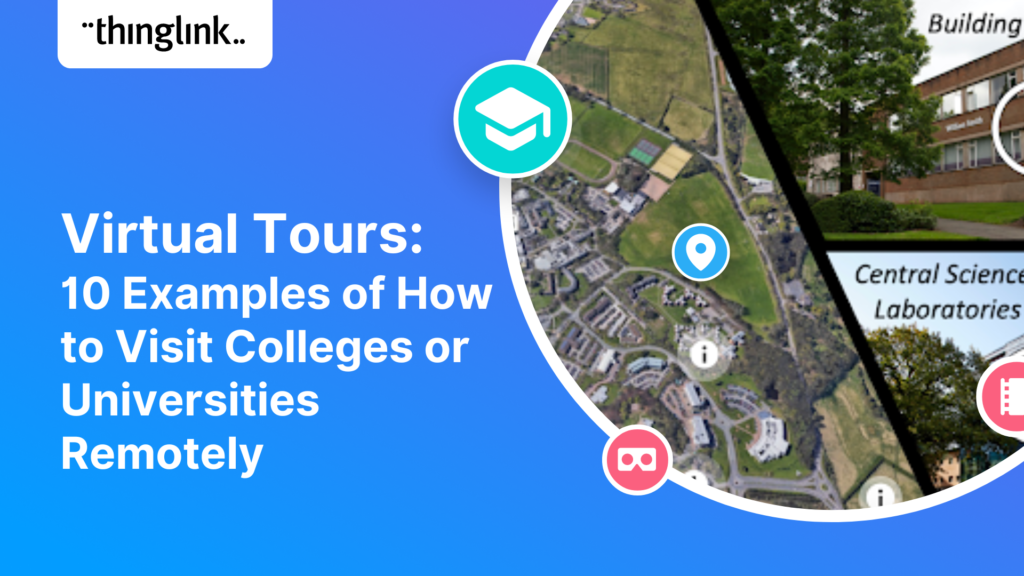
Virtual Tours: 10 Examples of How to Visit Colleges or Universities remotely
Wherever high school students plan to study, most would ideally like to do an on-campus visit to the schools that they are considering. But the covid pandemic made...
Wherever high school students plan to study, most would ideally like to do an on-campus visit to the schools that they are considering. But the covid pandemic made...
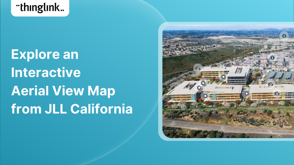
Making maps and aerial views actionable with interactive hotspots is one of the top use cases amongst all ThingLink user segments. Maps are especially conducive...
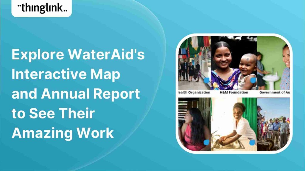
WaterAid is a remarkable organization who focuses on making clean water, decent toilets and good hygiene normal for everyone, everywhere. Read more about ...
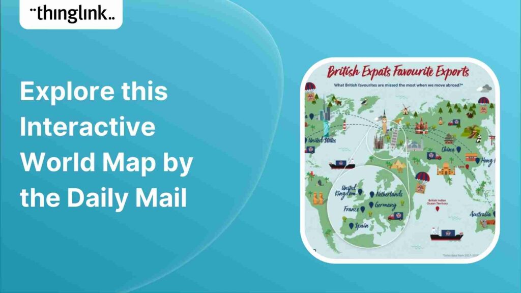
The Daily Mail uses an interactive map within their editorial article to showcase what British food favorites are missed most when moving abroad based on the most...
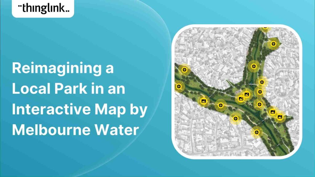
The Melbourne Water team has been working with residents, representatives from community groups and project partners to reimagine and co-design a section of Arnolds...
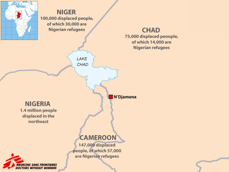
Featured image: An interactive map combining stats, quotes, and images to describe the refugee situation in the Lake Chad region. Creator: Doctors Without ...